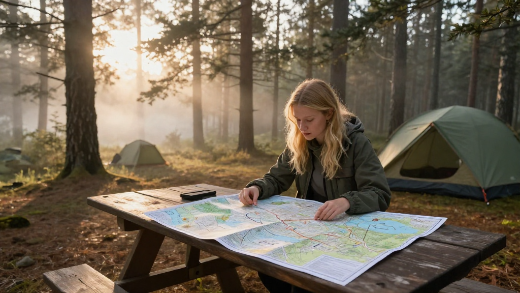
Understanding how to read maps effectively is crucial for any camping trip.
This comprehensive camping map reading guide will provide you with the essential skills you need to enhance your outdoor adventures and ensure a safe and enjoyable experience.
What is a Camping Map?
A camping map is a detailed representation of a specific area that includes topographic features, trails, campsites, water sources, and other landmarks.
Here’s what you might find on a typical camping map:
- Topographic lines: Represent the shape of the land and elevation changes.
- Trails: Indicated with specific colors or markings.
- Campsites: Locations designated for overnight stays.
- Water sources: Rivers, lakes, and streams highlighted for easy access.
Understanding these symbols is essential to navigating the wilderness successfully.
Why is a Camping Map Reading Guide Important?
Knowing how to read a map can prevent you from getting lost.
It also enhances your overall camping experience by helping you make informed decisions about your route.
Here are some key reasons why a camping map reading guide is important:
- Safety: Understanding your surroundings can keep you secure.
- Navigation: Accurate navigation prevents unnecessary detours.
- Exploration: Discover new areas and trails you might not have considered.
- Planning: Knowing where resources are located helps in preparation.
How Do You Start Reading a Camping Map?
Reading a camping map can be broken down into several steps:
-
Identify the Scale: The scale determines how much distance is represented on the map. A scale of 1:24,000 means 1 inch on the map equals 24,000 inches in the real world.
-
Understand the Legend: The map’s legend will explain what each symbol represents. Familiarize yourself with it before heading out.
-
Orient Yourself: Use a compass or your smartphone’s GPS to orient the map with your actual surroundings. Ensuring that the map aligns with the real world is vital for proper navigation.
-
Look for Landmarks: Identify prominent features around you, such as mountains, rivers, or roads, and locate them on your map.
-
Plan Your Route: Use the map to plan safe paths that consider elevation and terrain.
What Tools Do You Need for Camping Map Reading?
Proper tools enhance the map-reading experience. Essential tools include:
-
Topographic Map: Ensure it’s up to date and includes the area you plan to explore.
-
Compass: A traditional compass is a classic tool for navigation.
-
GPS Device or Smartphone: While maps are essential, having a GPS can offer real-time tracking.
-
Notepad and Pencil: Useful for jotting down notes or marking important locations on your map.
These tools will not only make you more confident in your navigation skills but will also help others in your group understand the terrain.
What Are the Basic Map Symbols to Know?
In every camping map reading guide, certain symbols frequently appear. Here are some basic symbols you should be familiar with:
-
Contour Lines: Show elevation and the shape of the land. Closely spaced lines indicate steep terrain.
-
Trail Markings: Often represented by dashed lines or different colors. Some maps denote trail difficulty.
-
Water Bodies: Lakes and rivers can be represented as blue areas. The size and shape help in identifying accessibility.
-
Campsites: Generally marked with tent icons or “C” for campsites.
Understanding these symbols will greatly enhance your navigation skills.
How Can You Enhance Your Camping Map Reading Skills?
Improving your map reading skills is a process.
Here are actionable tips:
-
Practice: Before heading out, practice reading maps at home. Familiarize yourself with various terrains.
-
Take a Workshop: Join a workshop on outdoor skills that often includes navigation training.
-
Use Online Resources: Websites and apps provide interactive maps to enhance your learning.
-
Go with an Experienced Camper: Learn from someone who is knowledgeable, as hands-on experience is invaluable.
What Should You Keep in Mind During a Camping Trip?
While navigating, there are several important considerations:
-
Weather Conditions: Be aware that weather can change rapidly in nature, which may affect your planned route.
-
Trail Conditions: Always check the latest trail conditions and any updates about closures or obstacles.
-
Wildlife Awareness: Know what wildlife exists in the area; respect their habitats and maintain distance.
-
Emergency Preparedness: Always have a plan for getting help if you get lost. Carry a whistle, a first-aid kit, and extra food and water.
-
team Communication: Talk to your group regularly. Each person’s understanding of the map can contribute to better navigation.
What Mistakes Should You Avoid When Reading Maps?
Some common mistakes can hinder effective map reading:
-
Ignoring the Legend: Failing to consult the legend can lead to misunderstandings about significant symbols.
-
Not Checking Elevation: Forgetting to consider elevation changes can lead to misjudged fitness levels required for the hike.
-
Failing to Update: Always use the latest maps; outdated versions can lead to confusion.
-
Relying Solely on Technology: Batteries can die, and phones can malfunction. Trust in your map skills and not just technology.
Conclusion
Reading a map for camping trips is an essential skill that every outdoor enthusiast should master.
This camping map reading guide provides insights into the importance of understanding maps, essential tools, key symbols, and practical skills.
By practicing these techniques, you’ll be better equipped for your next adventure.
Whether you’re planning a weekend getaway or a longer excursion, mastering map reading will keep you safe and enhance your overall experience in the great outdoors.
So, gather your tools, consult this guide, and get ready to embark on your next camping adventure with confidence!