The best compact handheld GPS devices make it easier to navigate beyond cellular coverage, whether you are hiking remote trails, surveying land, or traveling on the water.
Our 2026 roundup includes simple budget navigators, advanced multi-band receivers, marine-ready models, and satellite communicators. Use the guide below to match features, durability, and operating costs to your plans.
Best 10 Compact Handheld Gps Devices Picks for 2026
Reliable Trail Navigator

- 2.2-inch sunlight-readable color display
- TopoActive maps with routable trails
- Up to 25 hours on two AA batteries
Best For: Hiking and cycling navigation
Connected Safety Pick

- Two-way satellite messaging and SOS
- TracBack routing and digital compass
- Up to 14 days in tracking mode
Best For: Backcountry communication beyond cell coverage
Land Measurement Specialist

- Measures irregular areas and lengths
- Supports GPS and GLONASS
- Waterproof, dust-proof rubberized design
Best For: Field and land measurement tasks
High-Accuracy Navigation

- Multi-band and expanded GNSS support
- 2.6-inch sunlight-readable color display
- TopoActive maps and public land boundaries
Best For: Navigation in forests, steep terrain, and urban canyons
Best Compact Navigator

- Sunlight-readable 2.2-inch display
- Up to 1,800 hours in expedition mode
- Multi-GNSS, compass, and IPX7 water resistance
Best For: Extended hiking, camping, and geocaching trips
Best for Challenging Terrain
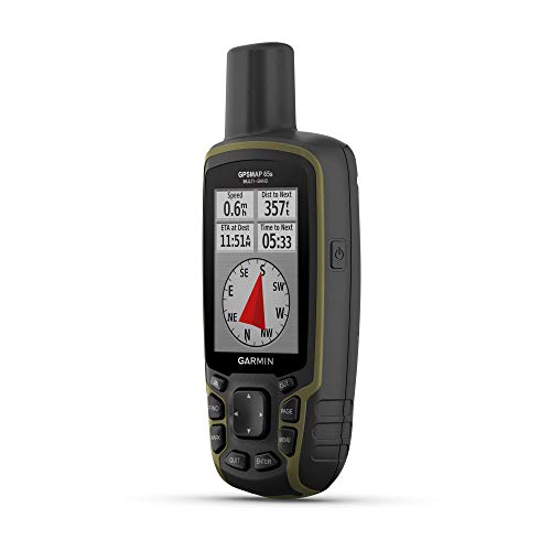
- Multi-band and expanded GNSS support
- 2.6-inch sunlight-readable color display
- Compass, altimeter, and TopoActive maps
Best For: Backcountry navigation in forests, canyons, and steep terrain
Best Budget Basic GPS

- Rugged, lightweight 5-ounce design
- Worldwide basemap with GPS and GLONASS
- Up to 20 hours on two AA batteries
Best For: Basic waypoint tracking, running, hiking, and geocaching
Best Compact All-Weather Pick
NiesahYan 3.2-Inch Handheld GPS

- 3.2-inch sunlight-readable screen with physical buttons
- Up to 36 hours of rechargeable battery life
- USA Topo maps and multi-GNSS support
Best For: Hikers and campers wanting long battery life and button controls
Best for Marine Use
Garmin GPSMAP 79s Floating Handheld GPS
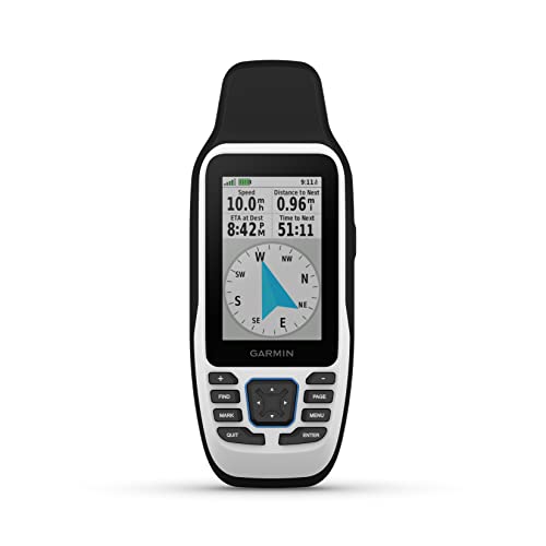
- Rugged housing floats in water
- Stores 10,000 waypoints and 250 routes
- Worldwide basemap and multi-constellation support
Best For: Boaters and anglers navigating around water
Best Lightweight Trail Navigator

- Lightweight 4.96-ounce design
- Preloaded routable TopoActive maps
- Up to 25 hours on two AA batteries
Best For: Hikers and cyclists wanting a lightweight, replaceable-battery GPS
Reliable Trail Navigator – Garmin eTrex 22x
The Garmin eTrex 22x is a practical choice for shoppers comparing compact handheld GPS devices for hiking, cycling, and general outdoor navigation. Its 2.2-inch sunlight-readable color display, preloaded routable maps, and support for both GPS and GLONASS provide dependable field navigation in a small, button-operated design.
Best For: Hikers and cyclists who want long battery life, built-in topographic mapping, and a rugged handheld format.
Pros:
- Preloaded TopoActive maps include routable roads and trails.
- GPS and GLONASS support can improve tracking in challenging environments.
- Runs for up to 25 hours on two AA batteries.
- Includes 8 GB of internal memory and a microSD card slot for map downloads.
Cons:
- The 2.2-inch display is smaller than the screens on some newer handheld GPS units.
- It uses buttons rather than a touchscreen.
Choose the eTrex 22x if straightforward navigation and extended battery life matter more than advanced satellite accuracy or satellite messaging. It is a well-rounded compact option for routine outdoor use.
Connected Safety Pick – Garmin inReach Mini 2
The Garmin inReach Mini 2 stands apart from typical compact handheld GPS devices by combining navigation with two-way satellite messaging and SOS capability. It is lightweight, water resistant, and designed to help users communicate beyond cellular coverage, though an active satellite subscription is required for those services.
Best For: Backcountry travelers who prioritize emergency communication, location sharing, and basic navigation in areas without cell service.
Pros:
- Supports two-way messaging and interactive SOS globally with an active subscription.
- TracBack routing helps guide you toward your starting point.
- Digital compass provides heading information even when stationary.
- Offers up to 14 days of battery life in 10-minute tracking mode.
Cons:
- Satellite messaging and SOS features require an active subscription.
- Its 1.27-inch monochrome display is compact for map viewing.
The inReach Mini 2 is best viewed as a communication-focused safety device with navigation features, not a full-featured mapping GPS. It makes the most sense for users who regularly travel beyond reliable cellular coverage.
Land Measurement Specialist – BEVA CM84 GPS Land Measurer
The BEVA CM84 is one of the more specialized compact handheld GPS devices in this roundup, built for measuring land rather than following recreational routes. It supports area and length measurements for irregular shapes, with a 2.4-inch LCD, GPS and GLONASS positioning, and a portable rubberized housing.
Best For: Landowners, farmers, and survey-related users measuring fields, slopes, lakes, and other irregular areas.
Pros:
- Measures area and length across straight, curved, sloped, and irregular shapes.
- Supports GPS and GLONASS satellite navigation systems.
- Provides a 2.4-inch 320 x 240 display for measurement readouts.
- Portable, rubberized, and designed with waterproof and dust-proof protection.
Cons:
- The stated area measurement error is 1–2%, so it is not positioned as a precision surveying instrument.
- Its approximately 12-hour battery life is shorter than some recreational GPS options.
- Its feature set is focused on measuring rather than detailed trail navigation.
Consider the CM84 when practical field measurement is the priority. Its specialized tools and pocket-friendly design may be more useful for land tasks than a conventional hiking navigator, but buyers should account for the stated measurement error.
High-Accuracy Navigation – Garmin GPSMAP 65
The Garmin GPSMAP 65 is a strong option among compact handheld GPS devices for users who navigate in difficult signal environments. Its expanded GNSS support and multi-band technology are designed to improve accuracy in steep terrain, urban canyons, and dense forests, while the 2.6-inch sunlight-readable color display keeps the interface practical outdoors.
Best For: Hikers, hunters, and outdoor users who need enhanced positioning performance in challenging terrain.
Pros:
- Expanded GNSS and multi-band technology target improved accuracy in difficult locations.
- Includes routable TopoActive mapping and U.S. federal public land boundaries.
- Works with Garmin Explore for managing tracks, routes, and waypoints.
- Uses a larger 2.6-inch sunlight-readable color display.
Cons:
- Battery life is rated at up to 16 hours, shorter than the eTrex 22x.
- It uses button controls rather than a touchscreen.
- The federal public land map coverage noted is for the U.S. only.
The GPSMAP 65 is the better fit when positioning reliability in demanding surroundings outweighs maximum battery duration. It adds useful mapping and planning support without abandoning the durability and direct controls associated with handheld GPS units.
Best Compact Navigator – Garmin eTrex SE
The Garmin eTrex SE is a practical choice among compact handheld GPS devices for hikers and campers who want a readable screen, long battery life, and straightforward button controls. Its multi-GNSS support and smartphone connectivity add useful flexibility for trip planning and field navigation.
Best For: Hikers, campers, and geocachers who prioritize extended battery life and a simple, weather-resistant navigator.
Pros:
- Sunlight-readable 2.2-inch high-resolution display
- Up to 168 hours in standard mode or 1,800 hours in expedition mode
- Multi-GNSS support, digital compass, and IPX7 water resistance
- Pairs with Garmin Explore for updates, planning, weather, and notifications
Cons:
- Two AA batteries are required and not included
- Advanced app features require a compatible smartphone
- Compact screen may feel limiting for users wanting extensive map detail
The eTrex SE stands out for endurance and ease of use. It is a strong fit when reliable basic navigation and long outings matter more than a large touchscreen or extensive built-in storage.
Best for Challenging Terrain – Garmin GPSMAP 65s
The Garmin GPSMAP 65s is one of the more capable compact handheld GPS devices for demanding outdoor environments. Multi-band technology, expanded GNSS support, a color display, and ABC sensors help it deliver a well-equipped navigation package for hikers, hunters, and backcountry users.
Best For: Outdoor users navigating forests, urban canyons, steep terrain, or other areas where positioning accuracy is especially important.
Pros:
- Multi-band and expanded GNSS support for challenging locations
- Sunlight-readable 2.6-inch color display
- Three-axis compass and barometric altimeter
- Includes routable TopoActive maps and U.S. federal public land boundaries
Cons:
- Battery life is rated at up to 16 hours
- Smartphone pairing is needed for Garmin Explore features
- Button-operated design may be less intuitive for users accustomed to touchscreens
The GPSMAP 65s is the most feature-focused option here for location accuracy and terrain awareness. Its shorter stated battery life makes spare batteries or careful power planning more important on longer trips.
Best Budget Basic GPS – Garmin eTrex 10
The Garmin eTrex 10 is a simple, rugged option for shoppers seeking compact handheld GPS devices without a color map display. It combines a worldwide basemap, button controls, paperless geocaching support, and IPX7 water resistance in a lightweight design.
Best For: Users who want basic waypoint and track navigation for hiking, running, geocaching, or general outdoor use.
Pros:
- Compact 5-ounce design with a 2.2-inch monochrome display
- Worldwide basemap and support for GPS, WAAS, and GLONASS
- IPX7 waterproof construction
- Runs for up to 20 hours on two AA batteries
Cons:
- Monochrome screen and 128 x 160 resolution provide limited visual detail
- Only 6 MB of listed storage
- Uses wired USB connectivity rather than wireless pairing
The eTrex 10 keeps navigation uncomplicated and durable. Choose it for basic position tracking and waypoint use; users who need richer maps, wireless features, or longer battery modes may prefer the newer eTrex SE or GPSMAP 65s.
Best Compact All-Weather Pick – NiesahYan 3.2-Inch Handheld GPS
For hikers who want compact handheld GPS devices with strong battery life and a readable display, this NiesahYan navigator combines a 3.2-inch sunlight-readable screen with physical buttons and a rugged IP66 water-resistant design. Multi-GNSS support, USA Topo maps, and 32 GB of storage make it a practical choice for hiking and camping.
Best For: Hikers and campers who prioritize long battery life, physical controls, and preloaded USA topographic maps.
Pros:
- Sunlight-readable 3.2-inch display with physical buttons
- Supports GPS, Galileo, BeiDou, and QZSS for positioning within 6 feet
- Up to 36 hours of rechargeable battery life via USB-C
- Includes a 3-axis compass, barometric altimeter, USA Topo maps, and 32 GB of storage
Cons:
- Non-touchscreen interface may feel less familiar to users who prefer touch controls
- IP66 water resistance is specified, rather than a fully submersible rating
Its combination of a large display, button controls, long runtime, and broad satellite support makes this a well-equipped option among compact handheld GPS devices for general outdoor navigation.
Best for Marine Use – Garmin GPSMAP 79s Floating Handheld GPS
Garmin GPSMAP 79s, Marine GPS Handheld with Worldwide Basemap, Rugged Design and Floats in Water
Check Price On AmazonThe Garmin GPSMAP 79s is one of the most purpose-built compact handheld GPS devices for boaters and anglers. Its rugged housing floats in water, carries an IPX6 water-resistance rating at the unit level, and includes a worldwide basemap for navigation in varied locations.
Best For: Boaters, anglers, and outdoor users who need a floating GPS with reliable waypoint and route capacity.
Pros:
- Floating, rugged design with IPX6 water resistance at the unit level
- Supports GPS, GLONASS, BeiDou, Galileo, QZSS, and SBAS
- Stores up to 10,000 waypoints, 250 routes, and 300 fit activities
- Includes a 3-axis electronic compass and barometric altimeter
Cons:
- Battery life is rated for up to 20 hours in GPS mode
- At 282 g, it is heavier than some smaller handheld GPS units
The floating construction and extensive waypoint capacity set the GPSMAP 79s apart, especially for marine navigation where dropping a device in the water is a realistic concern.
Best Lightweight Trail Navigator – Garmin eTrex 32x
The Garmin eTrex 32x is a lightweight choice for shoppers comparing compact handheld GPS devices for hiking, cycling, and everyday trail navigation. Its 2.2-inch sunlight-readable color display, preloaded routable TopoActive maps, and support for both GPS and GLONASS provide a straightforward navigation setup.
Best For: Hikers and cyclists who want a lightweight GPS with routable trail maps, expandable storage, and replaceable batteries.
Pros:
- Lightweight design weighing 4.96 ounces
- Sunlight-readable color display with preloaded routable TopoActive maps
- Supports GPS and GLONASS for tracking in challenging environments
- Includes 8 GB of memory, a microSD card slot, 3-axis compass, and barometric altimeter
Cons:
- Its 2.2-inch display is smaller than the screens on the other listed models
- Uses two AA batteries rather than a built-in rechargeable battery
With a low weight, replaceable AA batteries, and routable maps for roads and trails, the eTrex 32x is a sensible fit for users who prefer a simple, travel-ready navigation device.
How We Picked These Compact Handheld Gps Devices
We focused on handheld units that balance dependable positioning, outdoor durability, portability, and practical controls. The selection includes models with basic worldwide navigation, expanded satellite support, multi-band reception, electronic compasses, barometric altimeters, marine-focused construction, and satellite communication.
We also considered screen readability, button or touchscreen operation, mapping support, battery approach, water resistance, and the likely cost of accessories or subscription services. Because the right device depends heavily on the activity, this list includes both straightforward navigators and specialized options rather than treating every model as interchangeable.
Quick Comparison
| Best For | Features to Prioritize | Models to Consider |
|---|---|---|
| Budget navigation | Basic GPS reception, simple controls, long battery life | Garmin eTrex 10, eTrex 22x |
| General hiking | Color mapping, rugged construction, readable display | Garmin eTrex SE, eTrex 32x |
| Dense cover or difficult terrain | Multi-band positioning and expanded satellite support | Garmin GPSMAP 65, GPSMAP 65s |
| Emergency communication | Two-way satellite messaging and SOS capability | Garmin inReach Mini 2 |
| Boating | Floating housing, marine durability, water resistance | Garmin GPSMAP 79s |
| Land measurement | Measurement-focused functions and field portability | BEVA GPS Land Measuring Instrument |
Key Buying Factors for Compact Handheld Gps Devices
Positioning Performance
Standard GPS reception is sufficient for many trails and open areas. If you regularly travel under tree cover, near cliffs, or around tall buildings, a multi-band receiver and broader satellite-system support can improve consistency and reduce drift.
Maps and Screen Design
Check whether maps are included, downloadable, or sold separately. Color displays are generally easier for following trails and waypoints, while monochrome screens can reduce cost and extend battery life. A sunlight-readable display and physical buttons are useful when wearing gloves or operating in rain.
Compass, Altimeter, and Connectivity
An electronic compass can show direction while stationary, and a barometric altimeter helps track elevation changes. These features are valuable for hikers, climbers, and field users but may not justify a higher price for occasional navigation. Satellite communicators add messaging and emergency functions, but typically require an active subscription.
Battery, Durability, and Size
Compare expected battery life, replaceable versus rechargeable batteries, charging options, weight, and water resistance. A compact device should still be large enough to operate reliably and read in bright conditions. For boating, a floating design can provide important peace of mind.
Who Should Buy Which Compact Handheld Gps Devices?
Choose an entry-level eTrex model if you want dependable waypoint navigation at the lowest practical cost. Pick a color-screen model such as the eTrex SE or eTrex 32x for regular hiking and easier map use. The GPSMAP 65 or 65s is a better fit for demanding terrain and users who value advanced positioning; choose the 65s if an altimeter and compass matter.
Select the inReach Mini 2 when communication and SOS support are as important as location tracking. Boaters should favor the floating GPSMAP 79s, while land-measurement users should look for the BEVA instrument’s field-specific capabilities. Before buying, confirm map coverage, phone-app compatibility, included accessories, and any recurring service fees.