Understanding how to read a trail map is essential for anyone wanting to make the most of their camping experience. With the right knowledge, you can navigate the great outdoors, explore new trails, and ensure your safety while camping. This guide will equip you with the skills you need to read a trail map effectively.
What is a Trail Map?
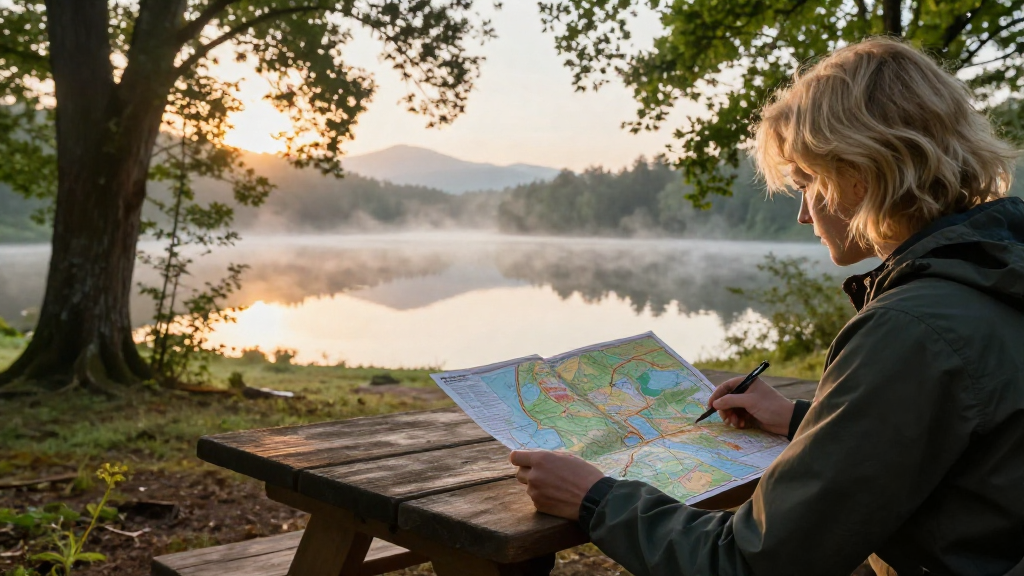
A trail map is a detailed representation of outdoor paths designed for hiking, biking, or other recreational activities.
These maps come with various features, including:
- Topographical lines showing elevation changes
- Trail markers indicating difficulty levels
- Points of interest such as lakes, viewpoints, and campsites
Understanding these features will help you navigate your camping adventures safely.
How to Read a Trail Map: Key Components
So, how to read a trail map effectively? Here are the key components you should familiarize yourself with:
1. Compass Rose
Most trail maps include a compass rose. This graphic indicates direction—North, East, South, and West.
Having a clear understanding of the compass directions will help you orient yourself when using a physical map in conjunction with a GPS device.
2. Legend and Symbols
Every trail map has a legend, which explains what each symbol means on the map. You’ll find symbols for:
- Trails: Different line styles represent trail types (hiking, biking, etc.)
- Campsites: Icons that indicate designated camping areas
- Water Sources: Symbols indicating rivers, lakes, and streams
Take time to review these before you head out.
3. Scale
Maps have a scale, showing the ratio between distance on the map and real-life distances.
It’s crucial for estimating how long a hike or a bike ride might take.
For example, if the map scale indicates that 1 inch equals 1 mile, a 3-inch trail will be approximately 3 miles long.
4. Contour Lines
Contour lines depict elevation changes on a trail map.
- Close Lines: Indicate steep inclines
- Wider Gaps: Suggest gentler slopes or flat areas
Learning to read contour lines can drastically improve your understanding of the trail difficulty.
How to Use a Trail Map While Camping
Once you know the key components, the next step is learning how to read a trail map in a practical context. Here are some steps to ensure you navigate your campsite confidently.
1. Orient Your Map
Before you start hiking, place your map flat and align it with the direction you’re facing.
This step will give you a sense of where nearby trails and landmarks are located.
2. Identify Your Location
Use landmarks, such as peaks or rivers, to determine your current location on the trail map.
Combining visual cues with the map will help you spot where you are.
3. Plan Your Route
Before you hit the trail, decide on a route.
Consider the following factors:
- Distance: Ensure it matches your skill level
- Elevation Gain: Select trails with suitable inclines
- Landmarks: Aim for points of interest along the way
4. Take Notes
When on the trail, jot down important notes or features you encounter. The landmarks you note can be referred back to when you look at the map again.
5. Keep Checking Your Position
Every so often, stop and check your position. Compare your surroundings with the trail map to ensure you’re following your planned route.
What Are the Benefits of Knowing How to Read a Trail Map?
Understanding how to read a trail map offers numerous benefits, including:
- Safety: Reduces the chances of getting lost
- Experience: Enhances your appreciation of nature and surroundings
- Planning: Allows for better-informed decisions about your journey
Can You Use a GPS or App Instead?
While GPS and apps can be handy tools for navigation, they do have limitations.
Here are several reasons why it’s beneficial to also know how to read a trail map:
- Battery Life: Mobile devices can lose power.
- Signal Issues: Areas with poor reception can hinder GPS usage.
- Accuracy: Maps can offer more accuracy over smaller features that apps might miss.
When Should You Practice Reading a Trail Map?
It’s best to practice how to read a trail map before heading to remote areas.
Here are some scenarios to consider:
- Local Nature Trails: Start with a familiar location.
- Group Outings: Use the map as a collaboration tool with friends or family.
- Camping Classes: Attend workshops at outdoor stores or parks.
Final Thoughts on How to Read a Trail Map While Camping
Gaining the skills to interpret a trail map is invaluable when you’re camping.
Whether you are exploring new wilderness areas or revisiting familiar paths, knowing how to read a trail map can make your adventures safer and more enjoyable.
By familiarizing yourself with the key components and practicing regularly, you’ll build the confidence necessary to navigate the great outdoors effectively.
Equip yourself with a good trail map, practice your skills, and embrace the beauty of nature with knowledge and assurance!